
Conservation
We have built websites, platforms and portals for organisations including BirdLife International, ZSL, WCS, Fauna & Flora, The Conservation Leadership Programme, WILDLABS.NET, IUCN, Trillion Trees, The Chagos Conservation Trust, The International Pole and Line Foundation, NUS Sustainability, The Angel Shark Project, Key Biodiversity Areas, the North Western Waters Advisory Council, TerrAdapt, Canopy, and OneEarth among others.
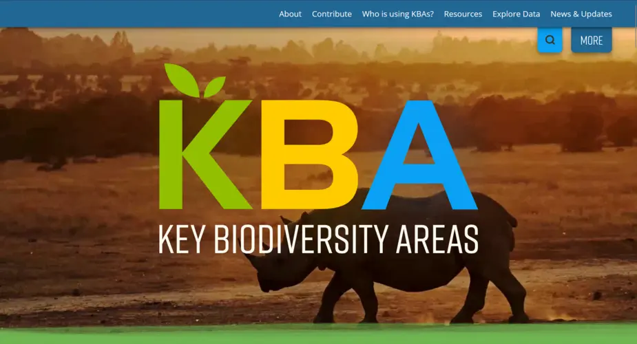
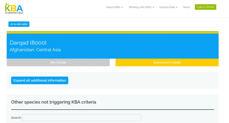
Key Biodiversity Areas website and community message board
We rebuilt the website for the Key Biodiversity Areas programme. Integrating a KBA site search using Apache Solr, redesigned site factsheets, all through a headless Drupal frontend using Next.JS
Categories
Technologies
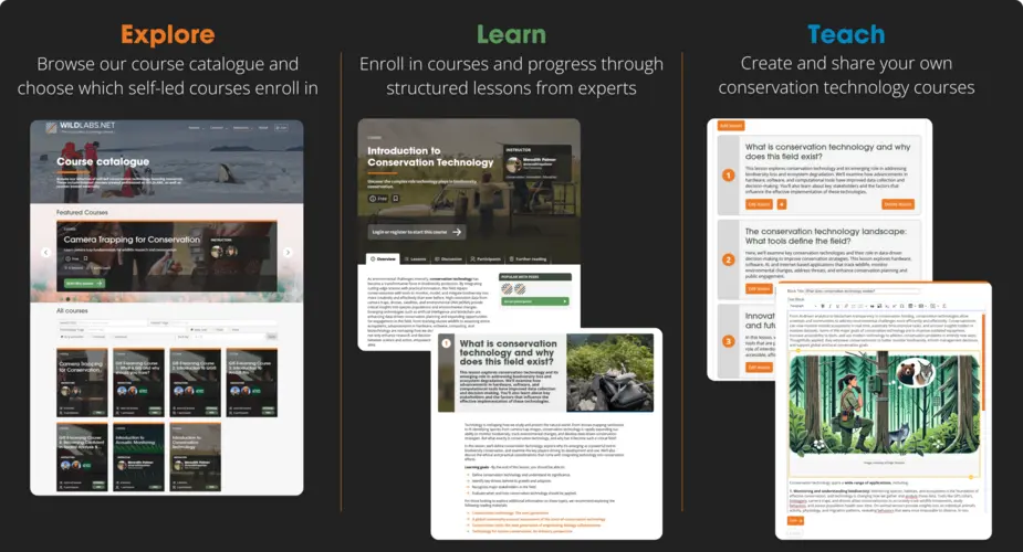
WILDLABS Courses - online learning platform
An online learning system for the WILDLABS.NET conservation technology platform.
Categories
Technologies
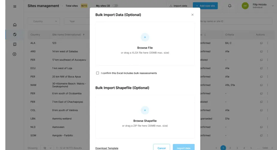
Key Biodiversity Areas database importers and geospatial database
We have worked with Birdlife International on their World Database of Keybiodiversity Areas since 2023 and in 2024 were asked to build a new system to allow organisations to bulk upload sites to be proposed as Key Biodiversity Areas.
Categories
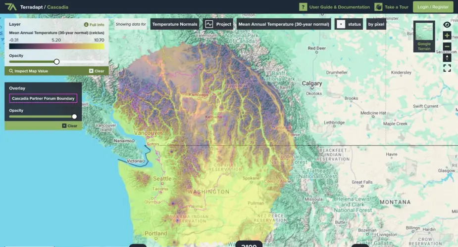
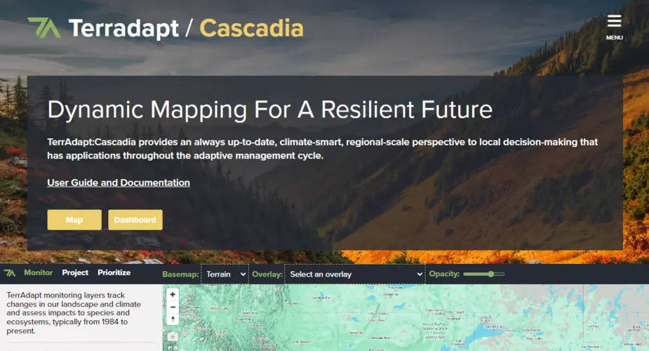
TerrAdapt geospatial analysis and reporting dashboard
Visualising projections of changes in natural environments
Categories
Technologies
Categories
Technologies
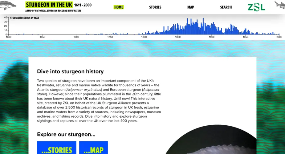
Interactive map, dashboard and portal for 400 years of UK sturgeon sightings
We worked with the Zoological Society of London (ZSL) to visualise 400 years of historic sturgeon sightings in the UK.
Categories
Technologies
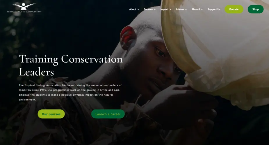
Tropical Biology Association website support
Since 2023 we have worked with the Tropical Biology Association to support and improve their WordPress website.
Categories
Technologies
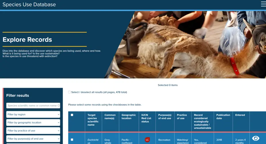
Species Use Database
Improving knowledge and understanding of how wild species are used, where they are used, if that use is sustainable or unsustainable, and what impacts that use is having.
Categories
Technologies
Key Biodiversity Areas factsheets scraper, archive and backup system
We worked with the Key Biodiversity Areas team at Birdlife International to build a scraper of their World Database of Key Biodiversity Areas
Categories
Technologies
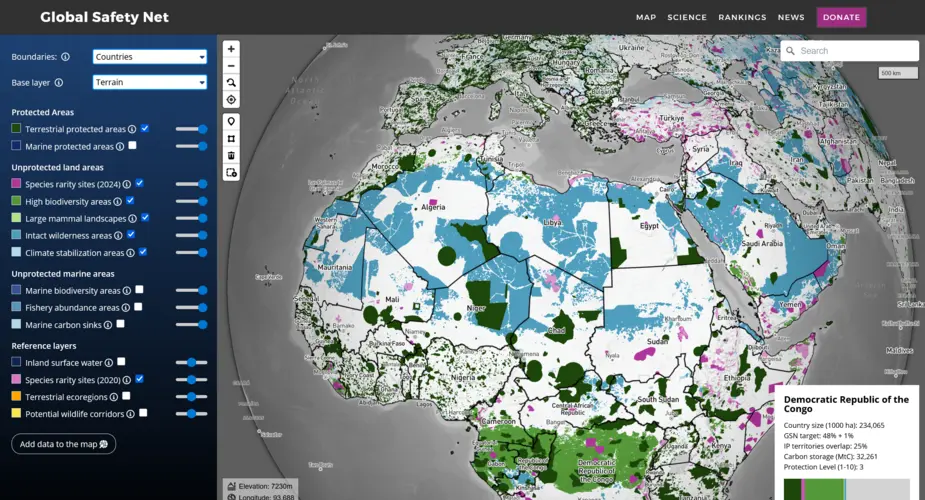
Global Safety Net map
We built a globe-view interactive map for One Earth's Global Safety Net project featuring more than a dozen categorised raster and vector layers and data queries mapped to a user selectable view of countries, ecoregions, bioregions and states.
Categories
Technologies
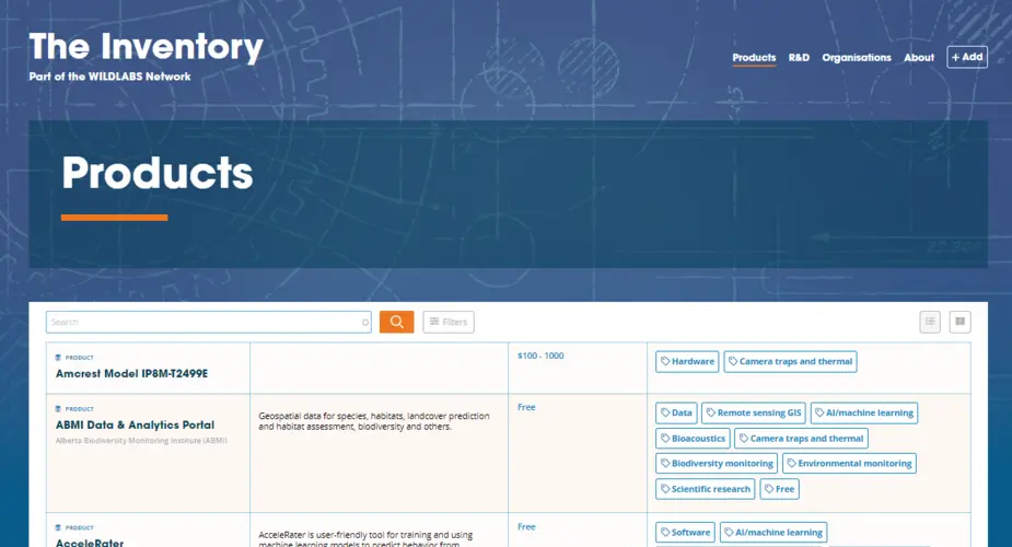
WILDLABS Inventory
The Inventory is a collaborative encyclopedia (wiki) of conservation technology and part of the WILDLABS.NET conservation technology community platform.
Categories
Technologies
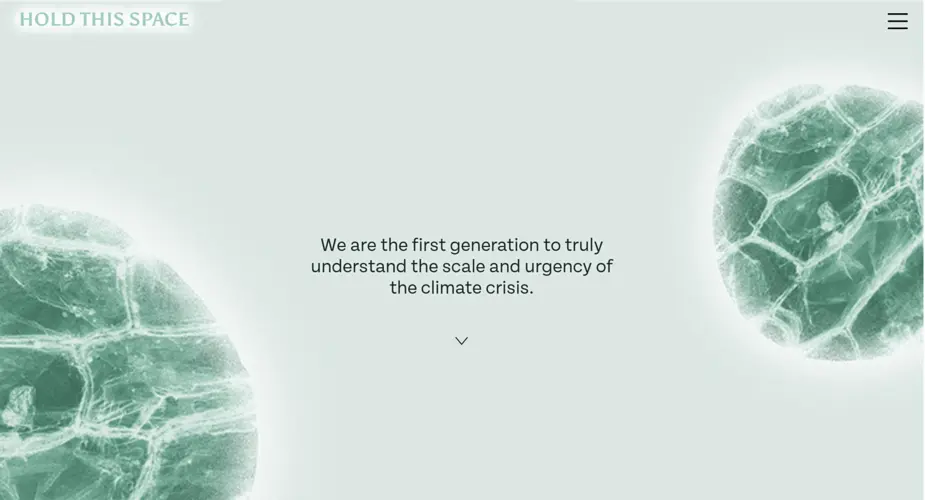
Our Stories Our Systems
We built a portal and interactive questionnaire centering around anxiety about climate change.
Categories
Technologies
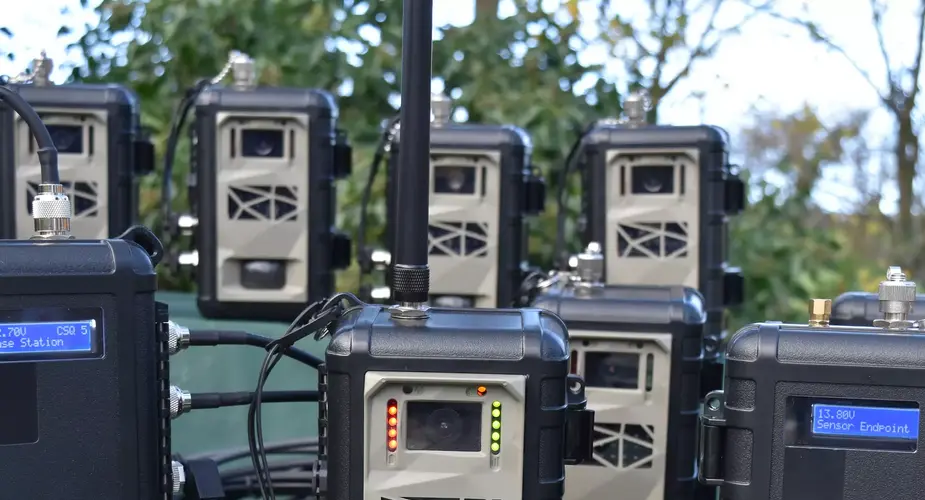
Instant Detect satellite wildlife monitoring system
Instant Detect 2.0 is a wildlife, environment and threat monitoring system designed by conservationists for conservationists. The system consists of multiple battery-powered cameras and sensors that capture images and data and then transmit it to the cloud in near real-time using satellite connectivity.
Categories
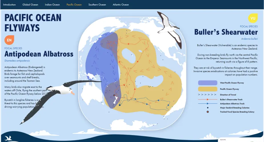
Seabird Flyways
We worked with BirdLife International on a project visualising their project on the "Six Major Bird 'Super Highways'.
Categories
Technologies
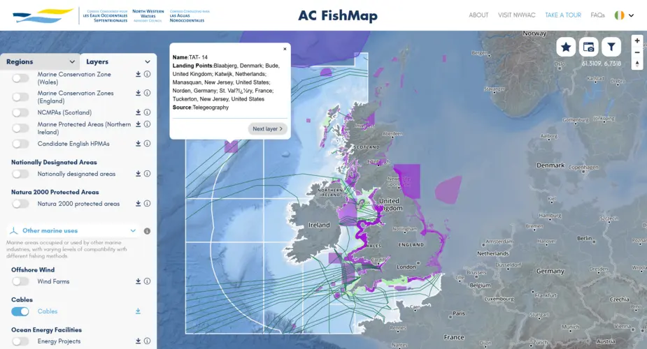
North Western Waters Advisory Council mutlingual interactive map (AC Fishmap)
A multi-lingual map for fishers and legal and conservation organisations containing dozens of layers and lists of fishing regulations.
Categories
Technologies
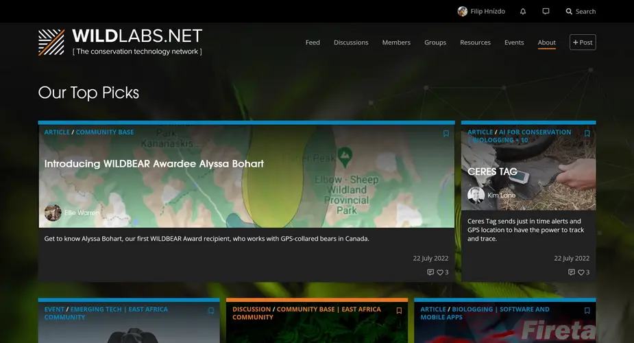
WILDLABS.NET
WILDLABS is a conservation technology community platform featuring discussion forums, community groups, instant messages, community sourced listings for events, jobs and funding opportunities and articles.
Categories
Technologies
Seabird Tracking Database
We built a new version of the collaborative Seabird Tracking Database for Birdlife International.
Categories
Technologies
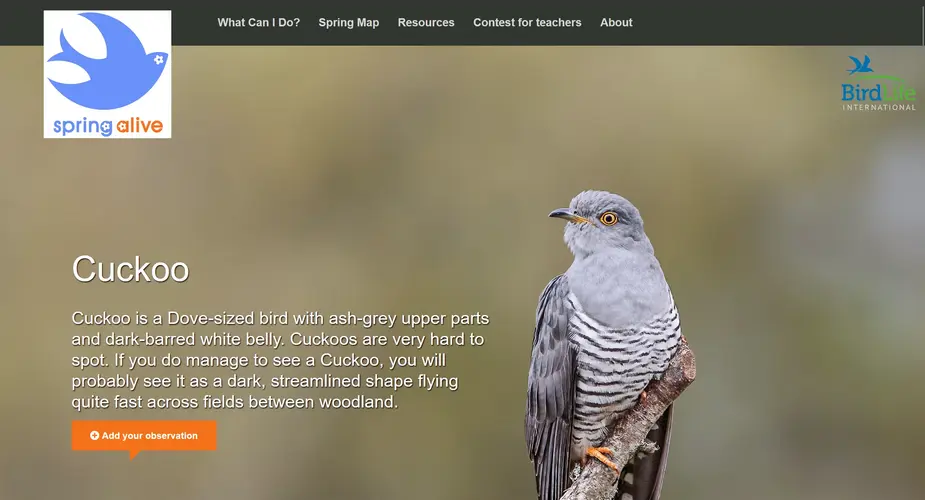
Spring Alive
We built a new, multilingual multisite for the Spring Alive citizen science project.
Categories
Technologies
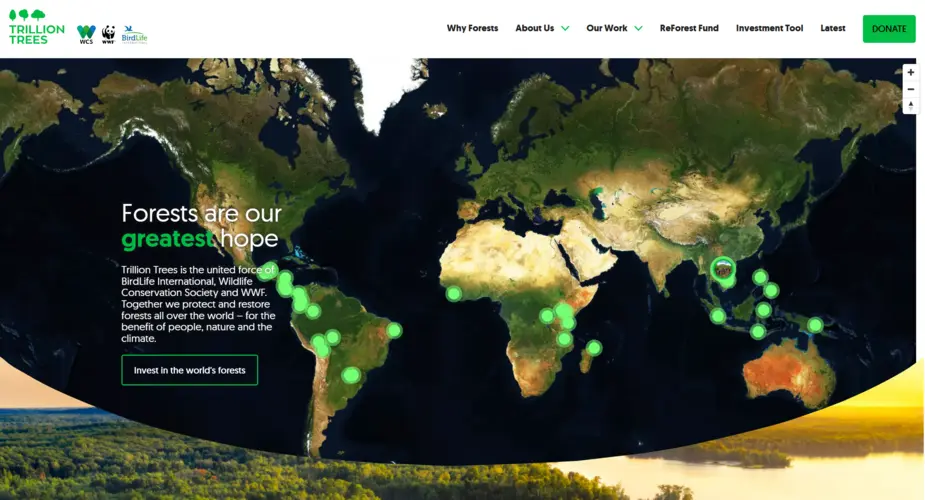
Trillion Trees website
We built a new website for Trillion Trees, showcasing their work across the world through features including a project directory and an interactive map.
Categories
Technologies
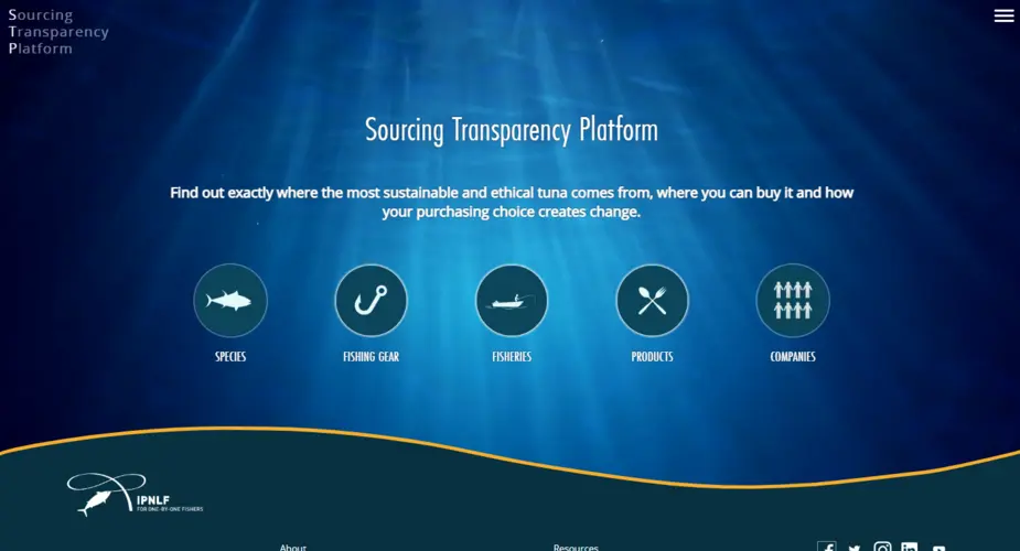
IPNLF - Sourcing Transparency Platform
We worked with The International Pole and Line Foundation on a database of tuna products, species, fisheries, gear types, vessels and companies.
Categories
Technologies
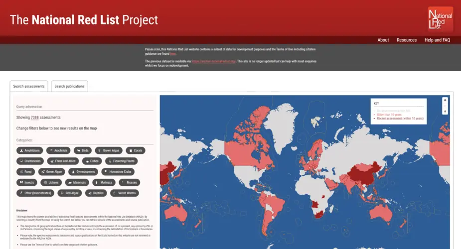
The National Red List Project
Creating a new database, interactive map and importer of thousands of historic records for the National Red List.
Categories
Technologies
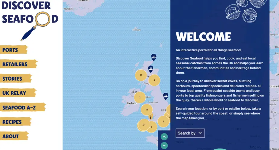
Discover Seafood
We worked with Mindfully Wired Communications and the Fishmongers Company to build an interactive online portal about locally caught seafood. Including a UK-wide map of ports and retailers, recipes, directory of species, stories from the fishing community and more.
Categories
Technologies
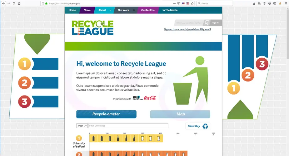
NUS - RecycleLeague pilot
We built a data visualisation showing live weekly recycling rates of various competing universities and other institutions.
Categories
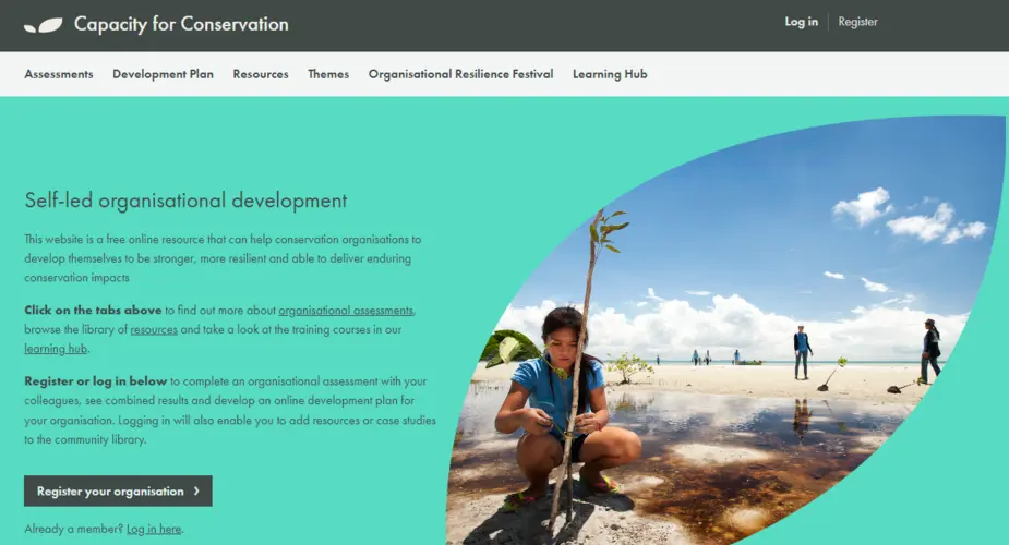
Capacity for Conservation multilingual organisation assessment tool and resource library
Capacity for Conservation is a free online resource that can help conservation organisations to develop themselves to be stronger, more resilient and able to deliver enduring conservation impacts.
Categories
Technologies
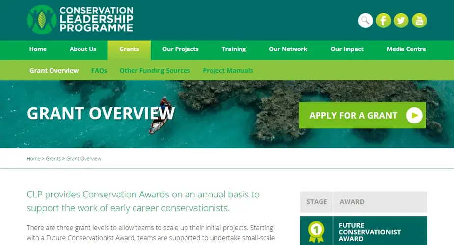
Conservation Leadership Programme
A WordPress based application portal system featuring a collaborative reviewer system, complex multi-group application forms, application cut off dates, MS Word export of reviews and applications, detailed exports and imports of data, quick assigning of reviewers and filtering of applications and more.
Categories
Technologies
TerrAdapt
Aside from our work with TerrAdapt on their geospatial visualisation, analysis and reporting tools Octophin built, designed and now support a website to showcase their work.
Categories
Technologies
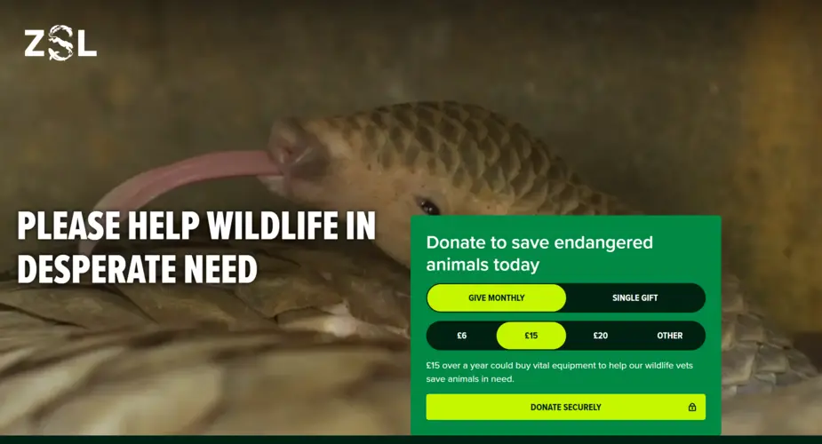
ZSL Donations, Patrons and Fellowship System
A highly customisable WordPress-based system for donations and membership.
Categories
Technologies
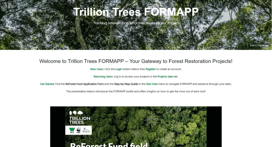
Trillion Trees Consultancy
Reforestation data collection research project for Trillion Trees (FORMAPP)
Categories
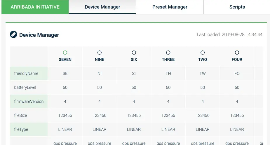
SCUTE - Conservation hardware administration system
SCUTE will build an extendable graphical administration interface for hardware devices from JSON schema files, allowing people to view reports about connected devices, update and manage configuration
Categories
Technologies
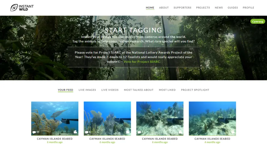
Instant Wild
Instant Wild is a gamified citizen science platform (including iOS and Android apps) where users can help identify species in camera trap imagery around the world.
Categories
Technologies
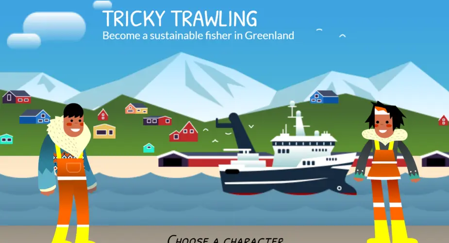
Tricky Trawling Greenland Fishing Game
A game teaching about the effects of trawl fishing on benthic life in Greenland
Categories
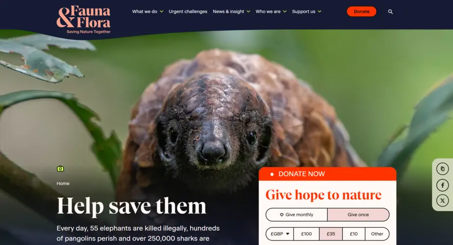
Fauna & Flora International - donations system support
We worked with Fauna & Flora International on creating better integration between their CRM system and donations payment gateway.
Categories
Technologies
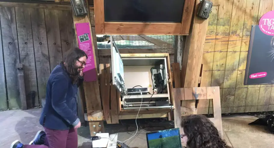
London Zoo's Tiger Territory touch screen interactive
An interactive touchscreen game to promote ZSL’s Instant Wild app
Categories
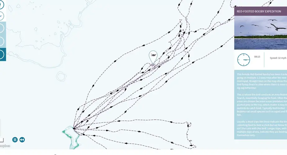
Chagos Information Portal - Tracking Map of Red Footed Booby Expedition
We animated and visualised the first tracking data from seabird species from the Chagos Archipelago. journey.
Categories
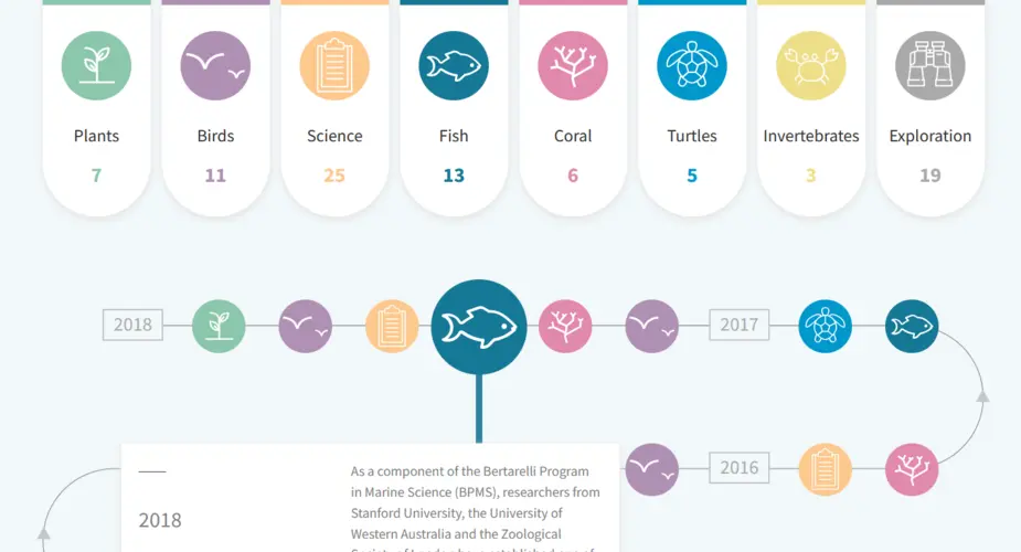
Chagos Information Portal - Interactive Timeline
An interactive timeline of expeditions
Categories
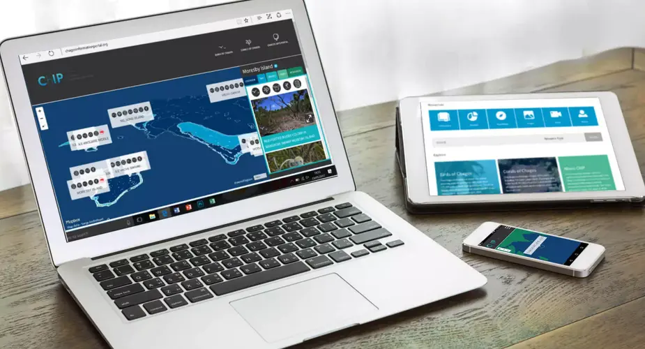
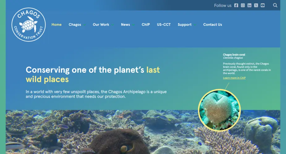
Chagos Information Portal
A resources library and interactive map landing page for UK charity the Chagos Conservation Trust.
Categories

ZSL - Food Web Interactive iPad Application
Easy to customise conservation education app for school groups.
Categories

Angel Shark sightings map
An interactive, multilingual map allowing divers to record sightings of the critically endangered species.
Categories
Technologies
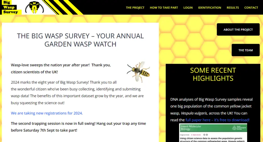
Big Wasp Survey
The Big Wasp Survey aims to gather important scientific data to help to quantify wasp species abunance, diversity and distribution.
Categories
Technologies
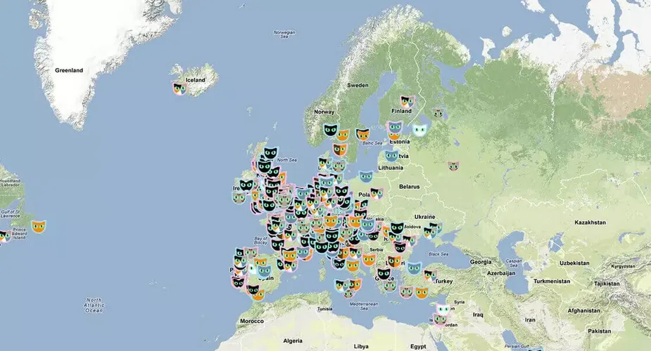
Cat Map - a viral success for London Zoo
An online campaign which would build excitement and buzz online about a brand-new big cat exhibit at ZSL London Zoo.
Categories
Technologies
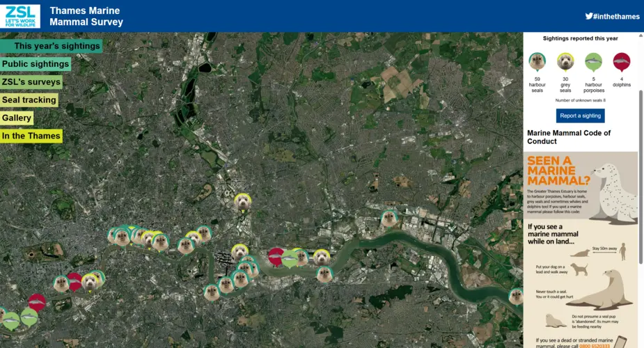
Thames Marine Mammal Map
An interactive citizen science map built for the Zoological Society of London’s Thames seal conservation project.
Categories
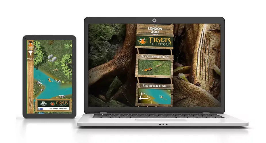
Tiger Territory game
Immerse yourself in Sumatra as a critically endangered tiger.