
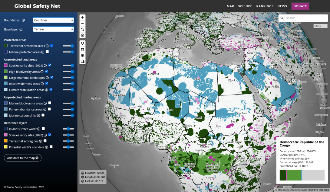
Global Safety Net map
"The first global-scale analysis of land areas requiring protection to solve the twin crises of biodiversity loss and climate change, upholding and strengthening Indigenous land rights."
We built a globe-view interactive map for One Earth's Global Safety Net project featuring more than a dozen categorised raster and vector layers and data queries mapped to a user selectable view of countries, ecoregions, bioregions and states.
As with many of our interactive mapping projects, the system was built using configuration files allowing new data and content to be added quickly and easily.
Mongabay article on the project and research paper: https://news.mongabay.com/2024/06/elon-musk-could-avert-global-species-extinction-with-only-a-portion-of-his-wealth/
Years
|
2023-2025
|
Categories
Interactive maps
GIS
Data collection / import
Database
API development
Data visualisation
Technologies
Mapbox
Google Earth Engine