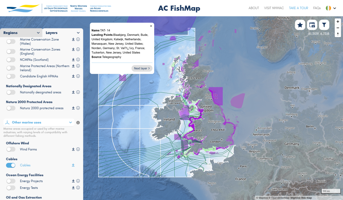
North Western Waters Advisory Council mutlingual interactive map (AC Fishmap)
A multi-lingual map for fishers and legal and conservation organisations containing dozens of layers and lists of fishing regulations.
A multi-lingual map for fishers and legal and conservation organisations containing dozens of layers and lists of fishing regulations.
We have possibly never mapped or collected as many different layer types as we did for the AC Fishmap. Everything from oil and gas pipelines and windfarms to ecoregions, fish colonies and regulatory areas.
We also featured tools such as live translation APIs on ever-changing data tooltips and a content management system to input changes in layers, regulations and translations. Helper layers such as bathymetric data and longitude and latitude grids were also included to help navigate the system.
We took part in many user groups with a large range of European fishing bodies to arrive at the final product.
The AC Fishmap can be viewed in English, French and Spanish at https://acfishmap.eu
Strategy
The huge wealth of shapefiles and fishing restrictions on the system and the multilingual aspect meant we needed to build a management system for uploading and editing shapefiles. Some of the data needed to be processed from multiple sources so we built Python scripts that could be reused every year when the data changes.
We gave the continent management team access to add new layers and categories of layers and also which information from these layers should be visible and how they should be displayed.
We standardised all of the data into geojson format for easy reading by the Mapbox visualisation layer.
Tech Stack
This project uses:
- Lots of Python and Node.js parsing and merging of shapefiles
- Mapbox for map hosting and display
- Drupal for the management of data layers directly by the NWWAC team
- Integrations with third party datasets for bathymetric data and other layers