
Our work
Octophin build interactive maps, apps, websites, community platforms and databases solely for the environment conservation, arts and heritage sectors.
We have world-leading knowledge on interactive mapping of all aspects of the natural world and its sustainable communities (from seafood to forestry), and have spoken on building maps for good at
several international conferences. We have built many collaborative databases of wildlife sightings, green spaces, sustainable seafood, recipes and more, and manage a community platform and wiki for conservation technologists and a citizen science wildife identification gaming platform both with thousands of active members.
On the arts side of our work we have worked on big data projects (demographic mapping, dashboard building) for Arts Council England via The Audience Agency and Artsadmin for many years, built the website for real world adventure games company HiddenCity (recently made an official partner of the 007 James Bond brand), built interactive maps and artist databases for the Crouch End Open Studios events and worked with Newham Council on digitisation projects for their new heritage centre.
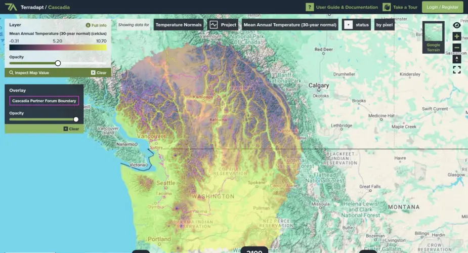
TerrAdapt geospatial analysis and reporting dashboard
Visualising projections of changes in natural environments
Categories
Technologies
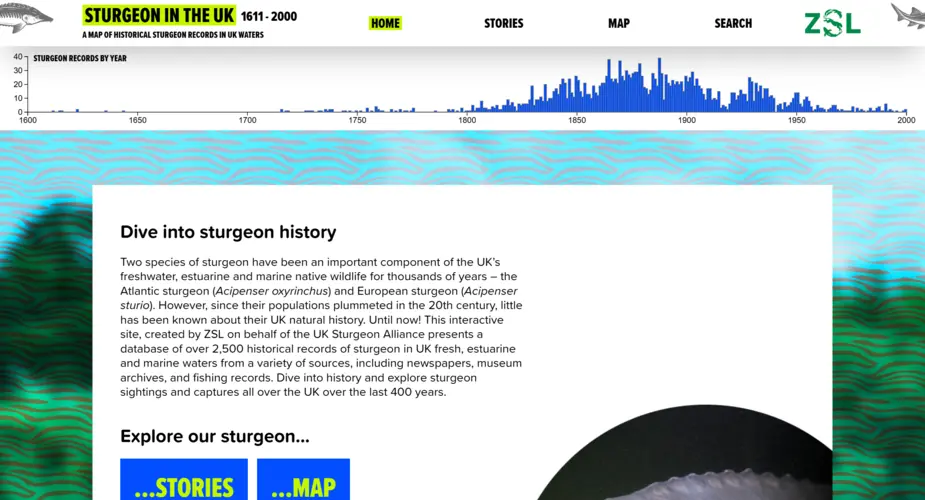
Interactive map, dashboard and portal for 400 years of UK sturgeon sightings
We worked with the Zoological Society of London (ZSL) to visualise 400 years of historic sturgeon sightings in the UK.
Categories
Technologies
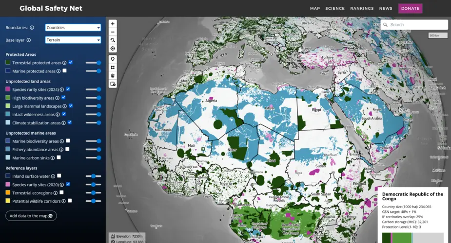
Global Safety Net map
We built a globe-view interactive map for One Earth's Global Safety Net project featuring more than a dozen categorised raster and vector layers and data queries mapped to a user selectable view of countries, ecoregions, bioregions and states.
Categories
Technologies
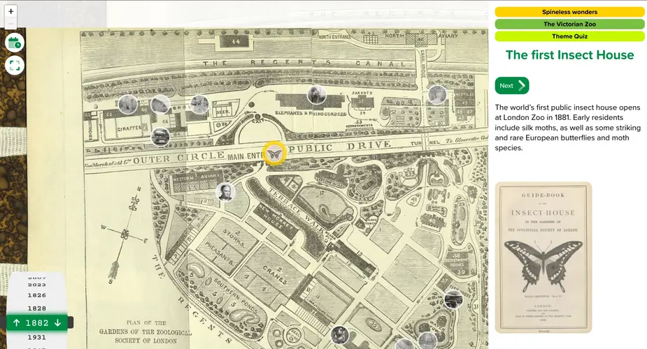
Time Traveller’s Guide to London Zoo
We built an interactive historical timeline for ZSL London Zoo powered by a flexible content management system and including features such as a quiz and multiple themes.
Categories
Technologies
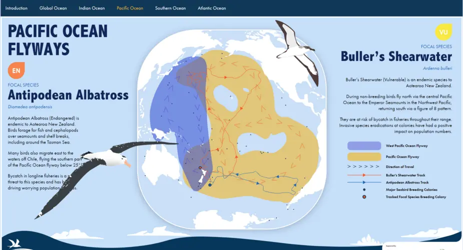
Seabird Flyways
We worked with BirdLife International on a project visualising their project on the "Six Major Bird 'Super Highways'.
Categories
Technologies
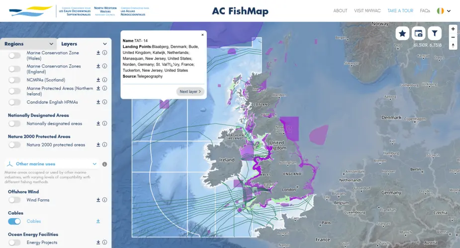
North Western Waters Advisory Council mutlingual interactive map (AC Fishmap)
A multi-lingual map for fishers and legal and conservation organisations containing dozens of layers and lists of fishing regulations.
Categories
Technologies
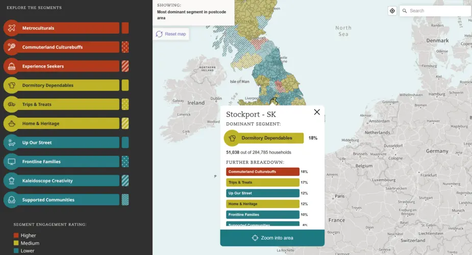
Interactive map of UK arts demographics
We used the Audience Agency's database of millions of (anonymised) bookers, placed into demographic categories using their Audience Spectrum system to plot the data onto an interactive map.
Categories
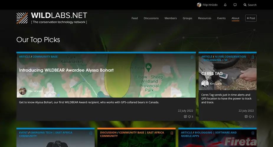
WILDLABS.NET
WILDLABS is a conservation technology community platform featuring discussion forums, community groups, instant messages, community sourced listings for events, jobs and funding opportunities and articles.
Categories
Technologies
Seabird Tracking Database
We built a new version of the collaborative Seabird Tracking Database for Birdlife International.
Categories
Technologies
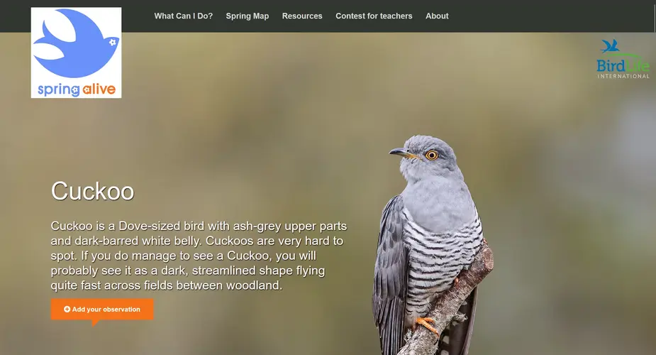
Spring Alive
We built a new, multilingual multisite for the Spring Alive citizen science project.
Categories
Technologies
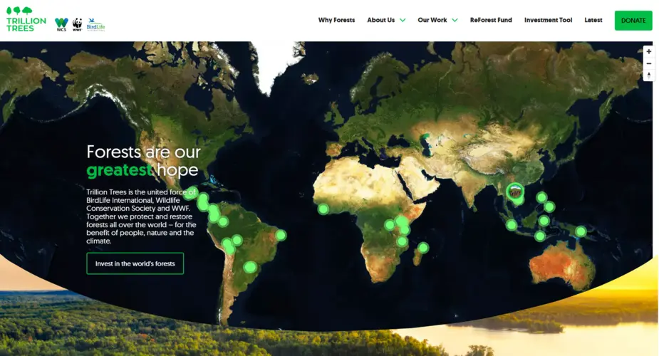
Trillion Trees website
We built a new website for Trillion Trees, showcasing their work across the world through features including a project directory and an interactive map.
Categories
Technologies
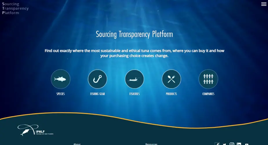
IPNLF - Sourcing Transparency Platform
We worked with The International Pole and Line Foundation on a database of tuna products, species, fisheries, gear types, vessels and companies.
Categories
Technologies
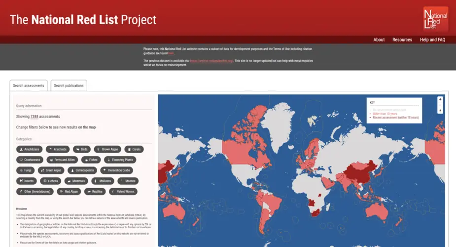
The National Red List Project
Creating a new database, interactive map and importer of thousands of historic records for the National Red List.
Categories
Technologies
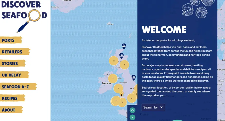
Discover Seafood
We worked with Mindfully Wired Communications and the Fishmongers Company to build an interactive online portal about locally caught seafood. Including a UK-wide map of ports and retailers, recipes, directory of species, stories from the fishing community and more.
Categories
Technologies
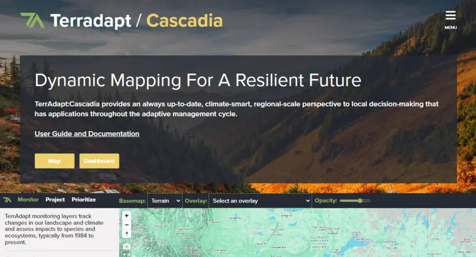
TerrAdapt
Aside from our work with TerrAdapt on their geospatial visualisation, analysis and reporting tools Octophin built, designed and now support a website to showcase their work.
Categories
Technologies
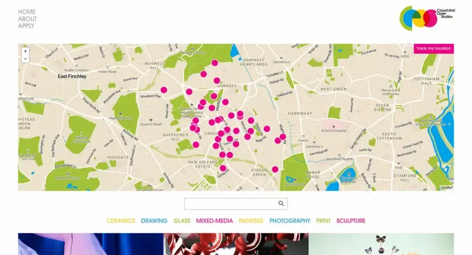
Crouch End Open Studios
A website and app that serves as a home to a directory of artists co-managed by the artists themselves, also a wayfinding system for visitors on open studios events.
Categories
Technologies
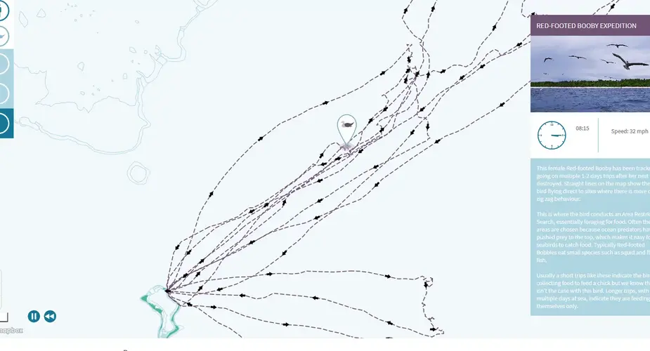
Chagos Information Portal - Tracking Map of Red Footed Booby Expedition
We animated and visualised the first tracking data from seabird species from the Chagos Archipelago. journey.
Categories
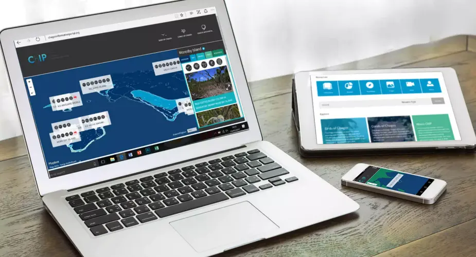
Chagos Information Portal
A resources library and interactive map landing page for UK charity the Chagos Conservation Trust.
Categories

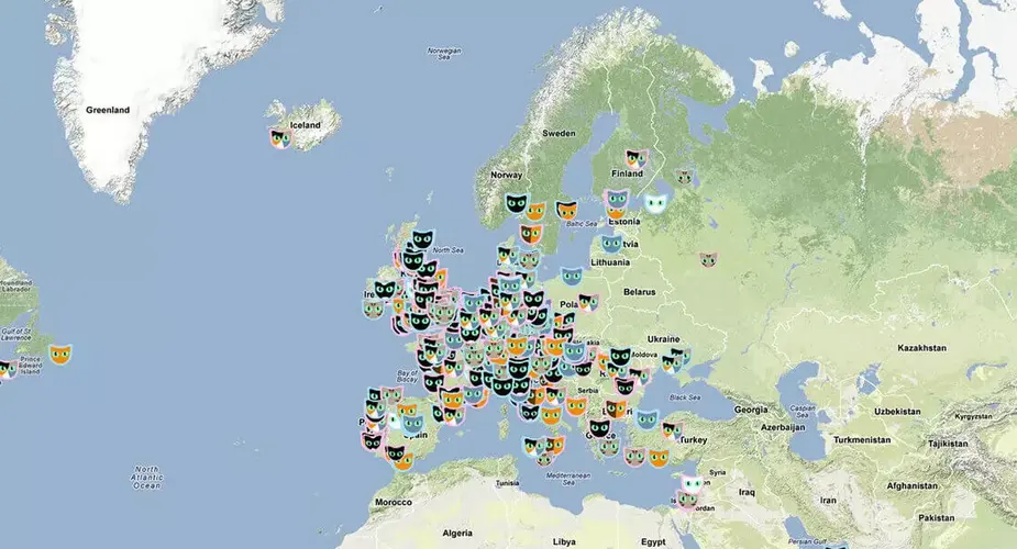
Angel Shark sightings map
An interactive, multilingual map allowing divers to record sightings of the critically endangered species.
Categories
Technologies
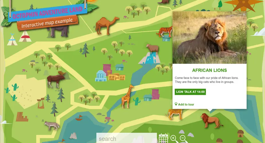
A custom interactive map builder for zoos, museums and art galleries
In 2016 we build a tool for quickly creating and managing interactive maps.
Categories
Cat Map - a viral success for London Zoo
An online campaign which would build excitement and buzz online about a brand-new big cat exhibit at ZSL London Zoo.
Categories
Technologies
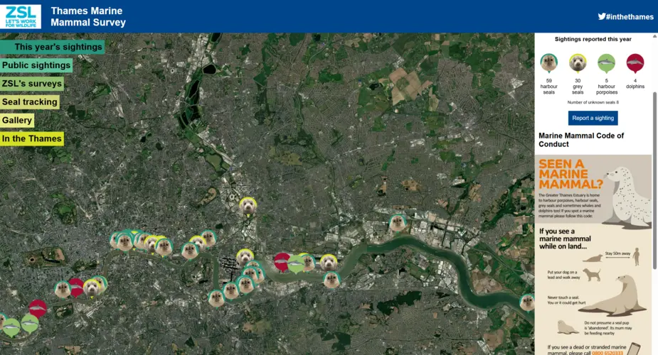
Thames Marine Mammal Map
An interactive citizen science map built for the Zoological Society of London’s Thames seal conservation project.