
Our work
Octophin build interactive maps, apps, websites, community platforms and databases solely for the environment conservation, arts and heritage sectors.
We have world-leading knowledge on interactive mapping of all aspects of the natural world and its sustainable communities (from seafood to forestry), and have spoken on building maps for good at
several international conferences. We have built many collaborative databases of wildlife sightings, green spaces, sustainable seafood, recipes and more, and manage a community platform and wiki for conservation technologists and a citizen science wildife identification gaming platform both with thousands of active members.
On the arts side of our work we have worked on big data projects (demographic mapping, dashboard building) for Arts Council England via The Audience Agency and Artsadmin for many years, built the website for real world adventure games company HiddenCity (recently made an official partner of the 007 James Bond brand), built interactive maps and artist databases for the Crouch End Open Studios events and worked with Newham Council on digitisation projects for their new heritage centre.
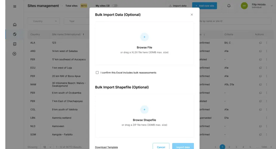
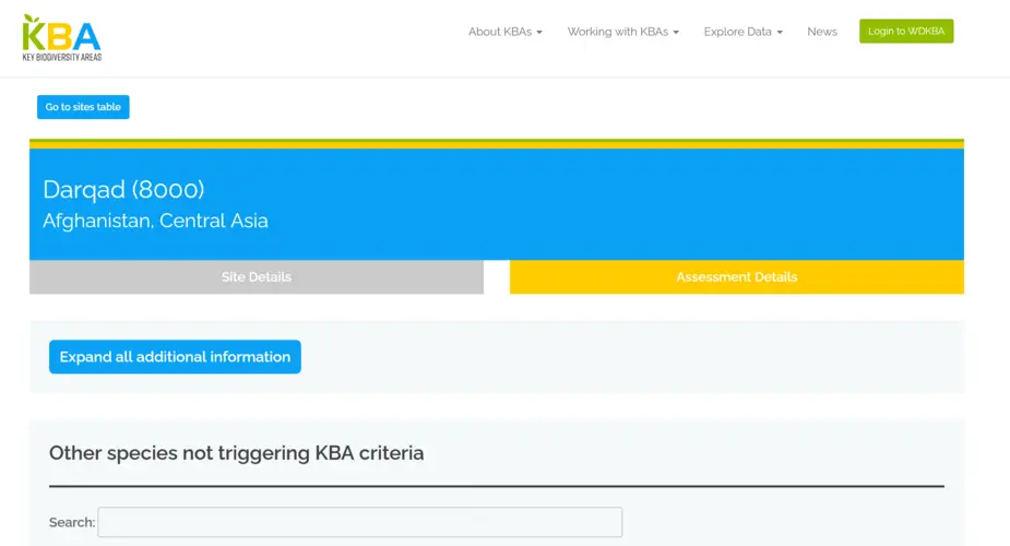
Key Biodiversity Areas database importers and geospatial database
We have worked with Birdlife International on their World Database of Keybiodiversity Areas since 2023 and in 2024 were asked to build a new system to allow organisations to bulk upload sites to be proposed as Key Biodiversity Areas.
Categories
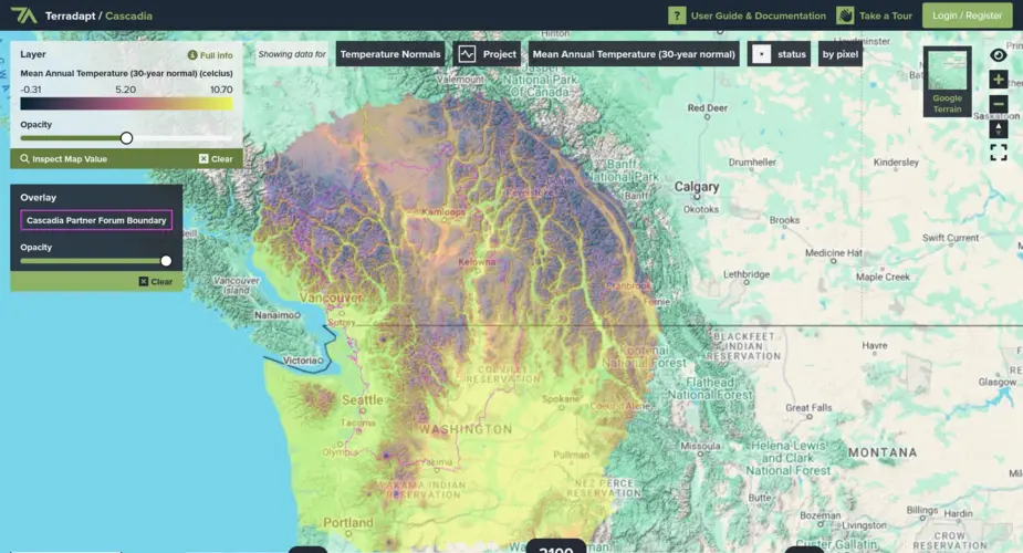
TerrAdapt geospatial analysis and reporting dashboard
Visualising projections of changes in natural environments
Categories
Technologies
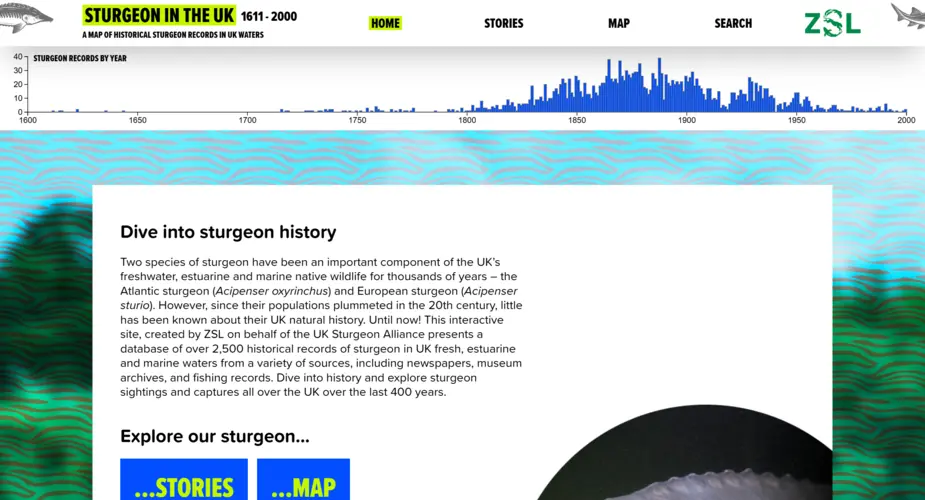
Interactive map, dashboard and portal for 400 years of UK sturgeon sightings
We worked with the Zoological Society of London (ZSL) to visualise 400 years of historic sturgeon sightings in the UK.
Categories
Technologies
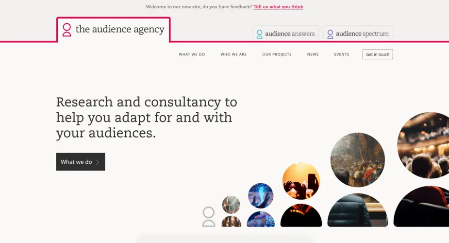
The Audience Agency - Multi-site system and three websites
We worked with The Audience Agency to build three interlinked websites each with their own urls, theme but sharing a server and some content.
Categories
Technologies
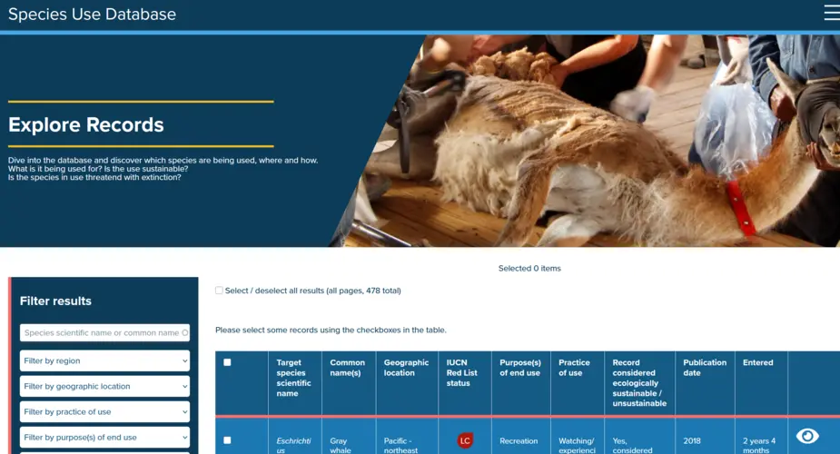
Species Use Database
Improving knowledge and understanding of how wild species are used, where they are used, if that use is sustainable or unsustainable, and what impacts that use is having.
Categories
Technologies
Key Biodiversity Areas factsheets scraper, archive and backup system
We worked with the Key Biodiversity Areas team at Birdlife International to build a scraper of their World Database of Key Biodiversity Areas
Categories
Technologies
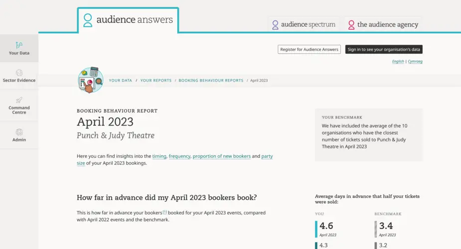
Booking Behaviour Report
Giving monthly insights into the timing, frequency, proportion of first time visitors and group dynamics of arts organisation bookings.
Categories
Technologies
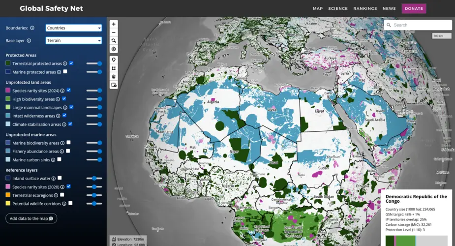
Global Safety Net map
We built a globe-view interactive map for One Earth's Global Safety Net project featuring more than a dozen categorised raster and vector layers and data queries mapped to a user selectable view of countries, ecoregions, bioregions and states.
Categories
Technologies
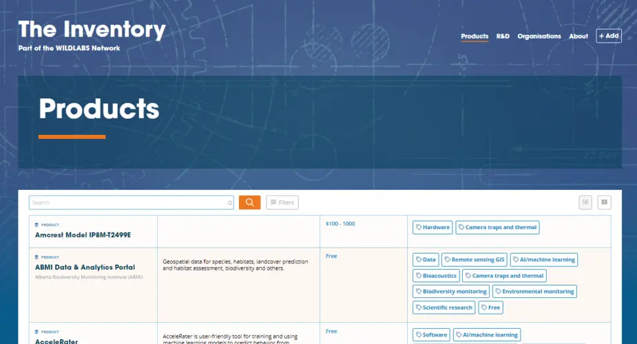
WILDLABS Inventory
The Inventory is a collaborative encyclopedia (wiki) of conservation technology and part of the WILDLABS.NET conservation technology community platform.
Categories
Technologies
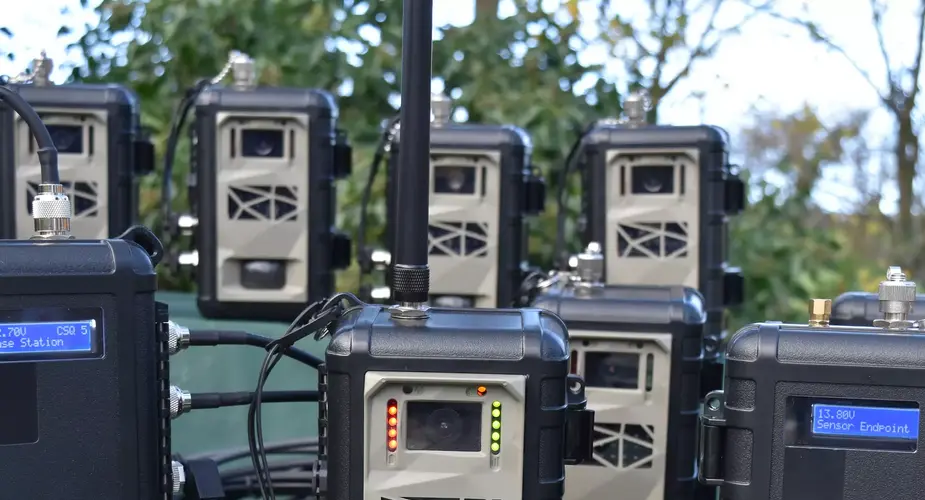
Instant Detect satellite wildlife monitoring system
Instant Detect 2.0 is a wildlife, environment and threat monitoring system designed by conservationists for conservationists. The system consists of multiple battery-powered cameras and sensors that capture images and data and then transmit it to the cloud in near real-time using satellite connectivity.
Categories
RAF Museum interactive touchscreen kiosk and archive database
Converting word documents and images into an interactive museum kiosk at RAF Museum.
Categories
Technologies
Seabird Tracking Database
We built a new version of the collaborative Seabird Tracking Database for Birdlife International.
Categories
Technologies
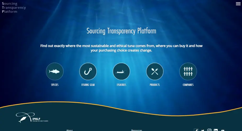
IPNLF - Sourcing Transparency Platform
We worked with The International Pole and Line Foundation on a database of tuna products, species, fisheries, gear types, vessels and companies.
Categories
Technologies
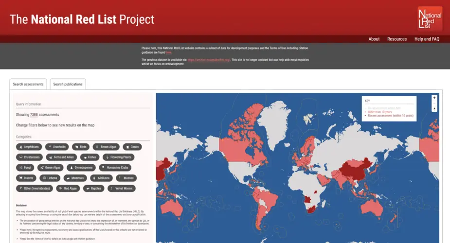
The National Red List Project
Creating a new database, interactive map and importer of thousands of historic records for the National Red List.
Categories
Technologies
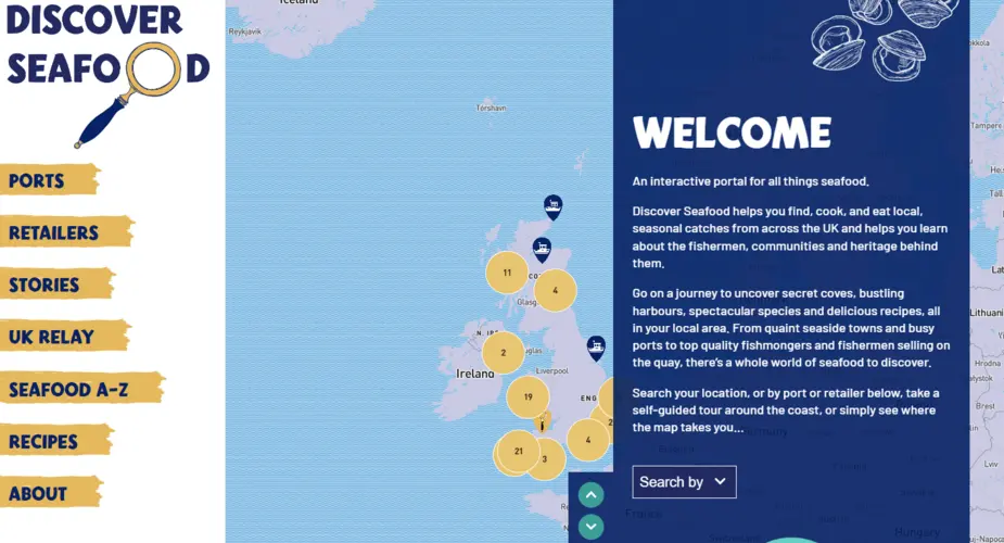
Discover Seafood
We worked with Mindfully Wired Communications and the Fishmongers Company to build an interactive online portal about locally caught seafood. Including a UK-wide map of ports and retailers, recipes, directory of species, stories from the fishing community and more.
Categories
Technologies
Ticketing pipelines and big data APIs for hundreds of arts venues in the UK
Octophin built ticketing pipelines for many ticketing systems (Spektrix, TicketSolve, Tessitura and more); creating APIs, scrapers and importers to ingest, parse, normalise, analyse and anonymise (via Experian APIs) daily data on tickets, people and events.
Categories
Technologies
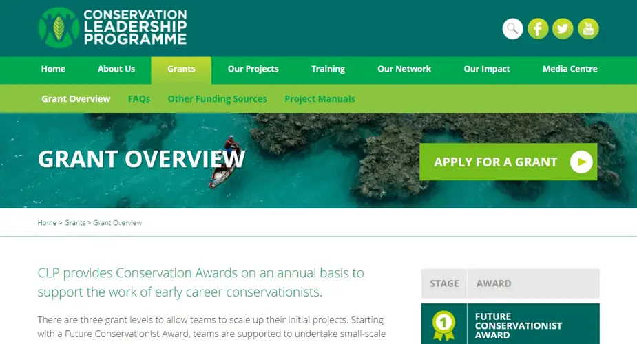
Conservation Leadership Programme
A WordPress based application portal system featuring a collaborative reviewer system, complex multi-group application forms, application cut off dates, MS Word export of reviews and applications, detailed exports and imports of data, quick assigning of reviewers and filtering of applications and more.
Categories
Technologies
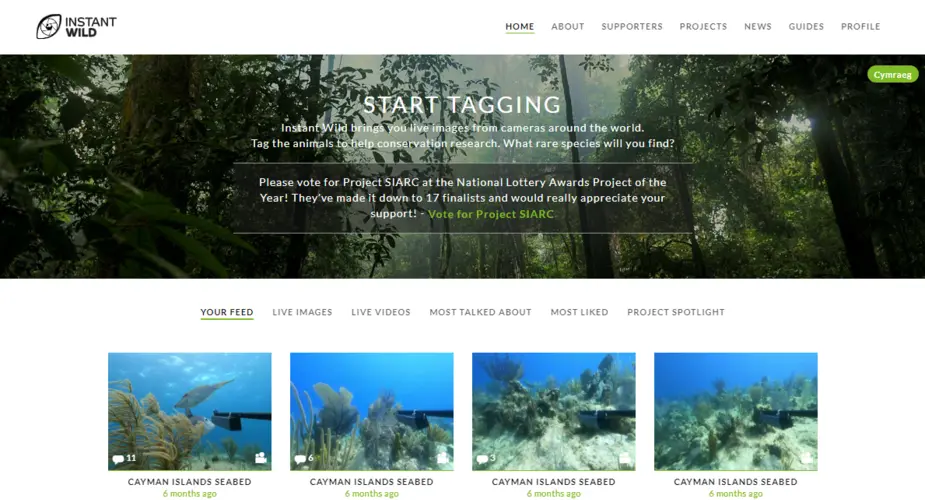
Instant Wild
Instant Wild is a gamified citizen science platform (including iOS and Android apps) where users can help identify species in camera trap imagery around the world.
Categories
Technologies
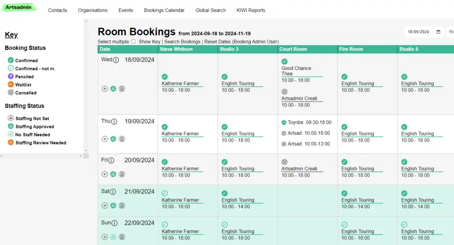
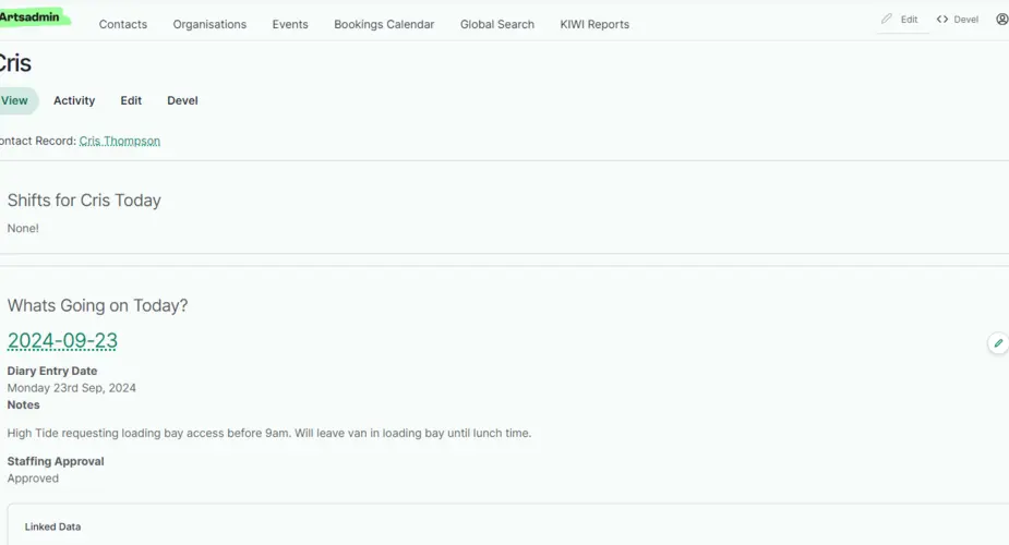
Artsadmin Room Bookings system
A room booking, staff management and equipment and catering system
Categories
Technologies
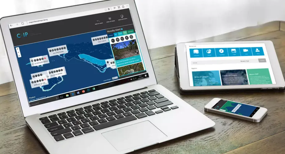
Chagos Information Portal
A resources library and interactive map landing page for UK charity the Chagos Conservation Trust.
Categories
Artsadmin CRM system
A customised customer relationship database solution for the arts sector
Categories
Technologies
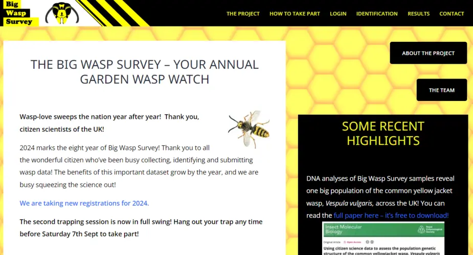
Big Wasp Survey
The Big Wasp Survey aims to gather important scientific data to help to quantify wasp species abunance, diversity and distribution.