
Our work
Octophin build interactive maps, apps, websites, community platforms and databases solely for the environment conservation, arts and heritage sectors.
We have world-leading knowledge on interactive mapping of all aspects of the natural world and its sustainable communities (from seafood to forestry), and have spoken on building maps for good at
several international conferences. We have built many collaborative databases of wildlife sightings, green spaces, sustainable seafood, recipes and more, and manage a community platform and wiki for conservation technologists and a citizen science wildife identification gaming platform both with thousands of active members.
On the arts side of our work we have worked on big data projects (demographic mapping, dashboard building) for Arts Council England via The Audience Agency and Artsadmin for many years, built the website for real world adventure games company HiddenCity (recently made an official partner of the 007 James Bond brand), built interactive maps and artist databases for the Crouch End Open Studios events and worked with Newham Council on digitisation projects for their new heritage centre.
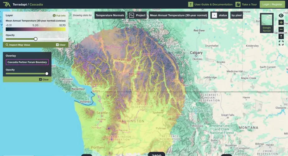
TerrAdapt geospatial analysis and reporting dashboard
Visualising projections of changes in natural environments
Categories
Technologies
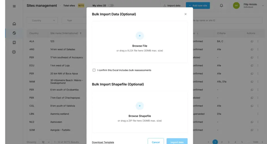
Key Biodiversity Areas database importers and geospatial database
We have worked with Birdlife International on their World Database of Keybiodiversity Areas since 2023 and in 2024 were asked to build a new system to allow organisations to bulk upload sites to be proposed as Key Biodiversity Areas.
Categories
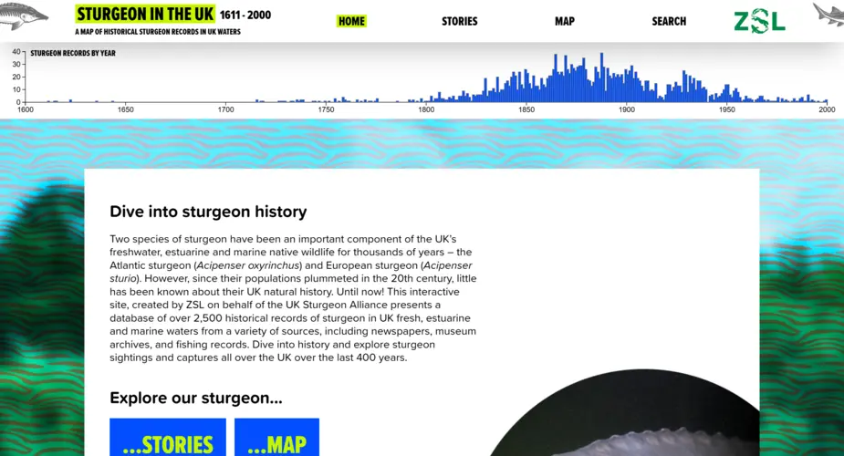
Interactive map, dashboard and portal for 400 years of UK sturgeon sightings
We worked with the Zoological Society of London (ZSL) to visualise 400 years of historic sturgeon sightings in the UK.
Categories
Technologies
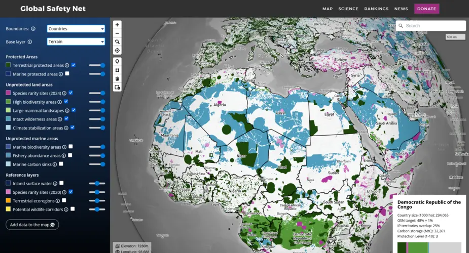
Global Safety Net map
We built a globe-view interactive map for One Earth's Global Safety Net project featuring more than a dozen categorised raster and vector layers and data queries mapped to a user selectable view of countries, ecoregions, bioregions and states.
Categories
Technologies
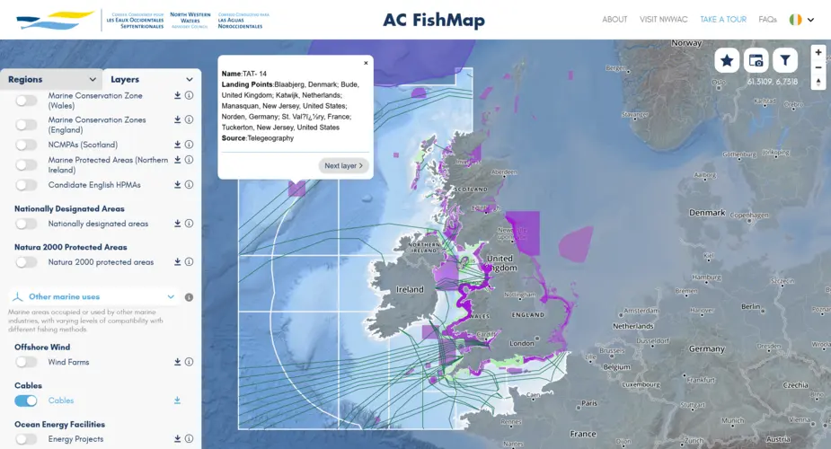
North Western Waters Advisory Council mutlingual interactive map (AC Fishmap)
A multi-lingual map for fishers and legal and conservation organisations containing dozens of layers and lists of fishing regulations.
Categories
Technologies
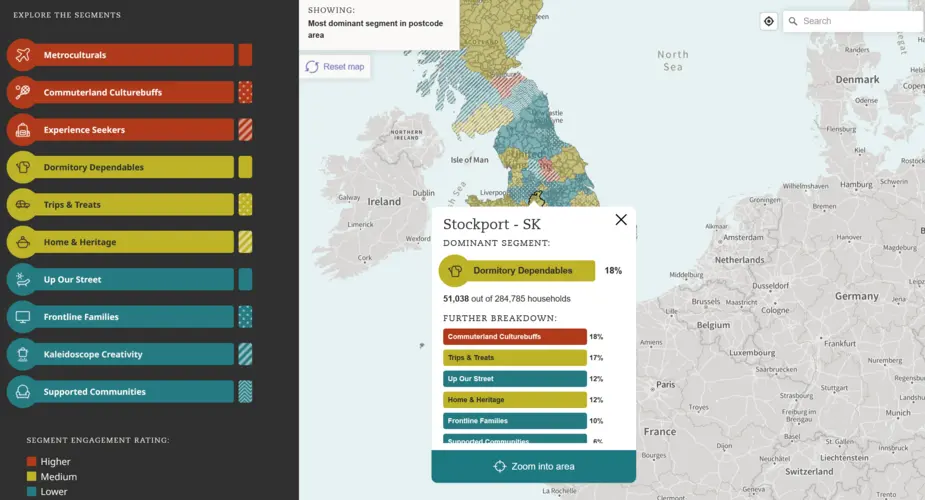
Interactive map of UK arts demographics
We used the Audience Agency's database of millions of (anonymised) bookers, placed into demographic categories using their Audience Spectrum system to plot the data onto an interactive map.
Categories
Seabird Tracking Database
We built a new version of the collaborative Seabird Tracking Database for Birdlife International.