
Our work
Octophin build interactive maps, apps, websites, community platforms and databases solely for the environment conservation, arts and heritage sectors.
We have world-leading knowledge on interactive mapping of all aspects of the natural world and its sustainable communities (from seafood to forestry), and have spoken on building maps for good at
several international conferences. We have built many collaborative databases of wildlife sightings, green spaces, sustainable seafood, recipes and more, and manage a community platform and wiki for conservation technologists and a citizen science wildife identification gaming platform both with thousands of active members.
On the arts side of our work we have worked on big data projects (demographic mapping, dashboard building) for Arts Council England via The Audience Agency and Artsadmin for many years, built the website for real world adventure games company HiddenCity (recently made an official partner of the 007 James Bond brand), built interactive maps and artist databases for the Crouch End Open Studios events and worked with Newham Council on digitisation projects for their new heritage centre.
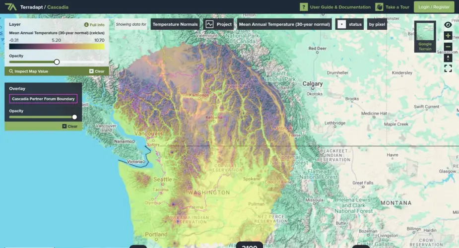
TerrAdapt geospatial analysis and reporting dashboard
Visualising projections of changes in natural environments
Categories
Technologies
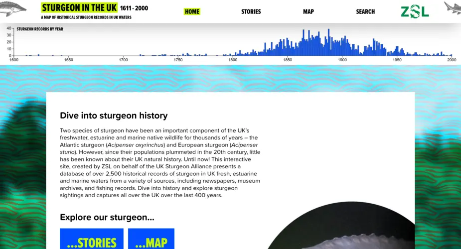
Interactive map, dashboard and portal for 400 years of UK sturgeon sightings
We worked with the Zoological Society of London (ZSL) to visualise 400 years of historic sturgeon sightings in the UK.
Categories
Technologies
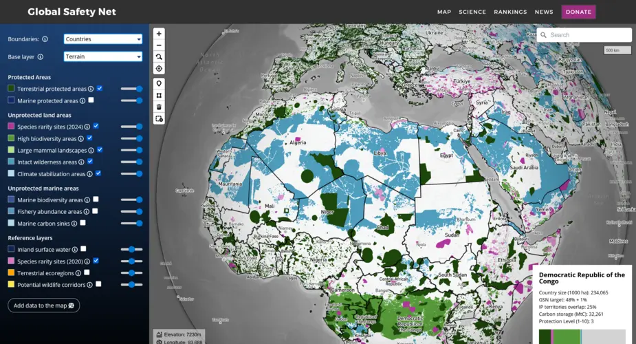
Global Safety Net map
We built a globe-view interactive map for One Earth's Global Safety Net project featuring more than a dozen categorised raster and vector layers and data queries mapped to a user selectable view of countries, ecoregions, bioregions and states.
Categories
Technologies
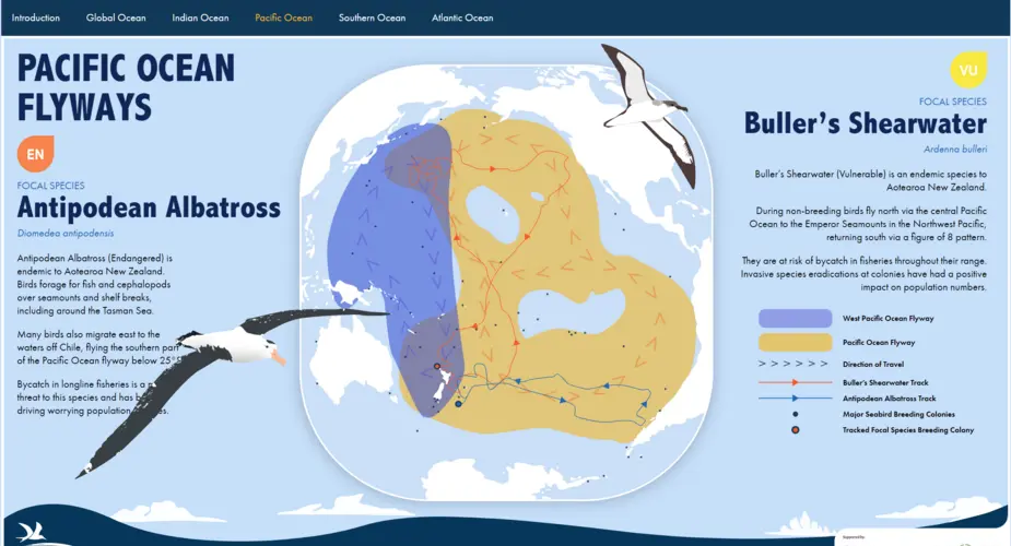
Seabird Flyways
We worked with BirdLife International on a project visualising their project on the "Six Major Bird 'Super Highways'.
Categories
Technologies
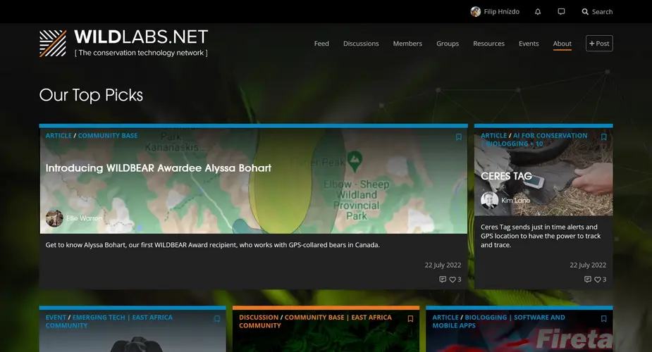
WILDLABS.NET
WILDLABS is a conservation technology community platform featuring discussion forums, community groups, instant messages, community sourced listings for events, jobs and funding opportunities and articles.
Categories
Technologies
Seabird Tracking Database
We built a new version of the collaborative Seabird Tracking Database for Birdlife International.
Categories
Technologies
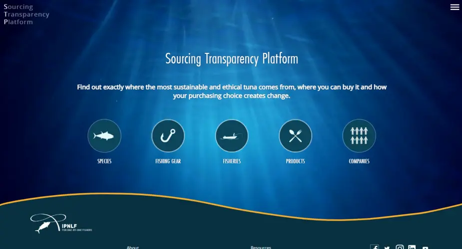
IPNLF - Sourcing Transparency Platform
We worked with The International Pole and Line Foundation on a database of tuna products, species, fisheries, gear types, vessels and companies.
Categories
Technologies
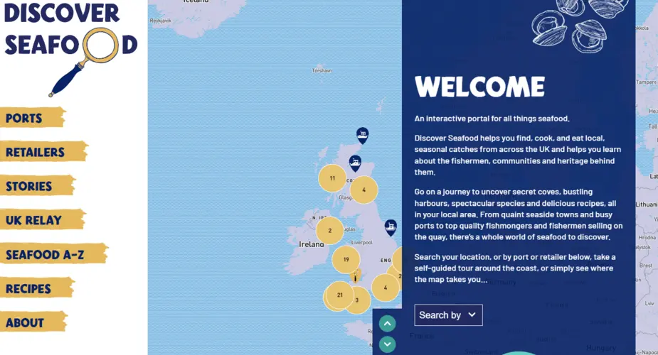
Discover Seafood
We worked with Mindfully Wired Communications and the Fishmongers Company to build an interactive online portal about locally caught seafood. Including a UK-wide map of ports and retailers, recipes, directory of species, stories from the fishing community and more.
Categories
Technologies

Angel Shark sightings map
An interactive, multilingual map allowing divers to record sightings of the critically endangered species.