
Our work
Octophin build interactive maps, apps, websites, community platforms and databases solely for the environment conservation, arts and heritage sectors.
We have world-leading knowledge on interactive mapping of all aspects of the natural world and its sustainable communities (from seafood to forestry), and have spoken on building maps for good at
several international conferences. We have built many collaborative databases of wildlife sightings, green spaces, sustainable seafood, recipes and more, and manage a community platform and wiki for conservation technologists and a citizen science wildife identification gaming platform both with thousands of active members.
On the arts side of our work we have worked on big data projects (demographic mapping, dashboard building) for Arts Council England via The Audience Agency and Artsadmin for many years, built the website for real world adventure games company HiddenCity (recently made an official partner of the 007 James Bond brand), built interactive maps and artist databases for the Crouch End Open Studios events and worked with Newham Council on digitisation projects for their new heritage centre.
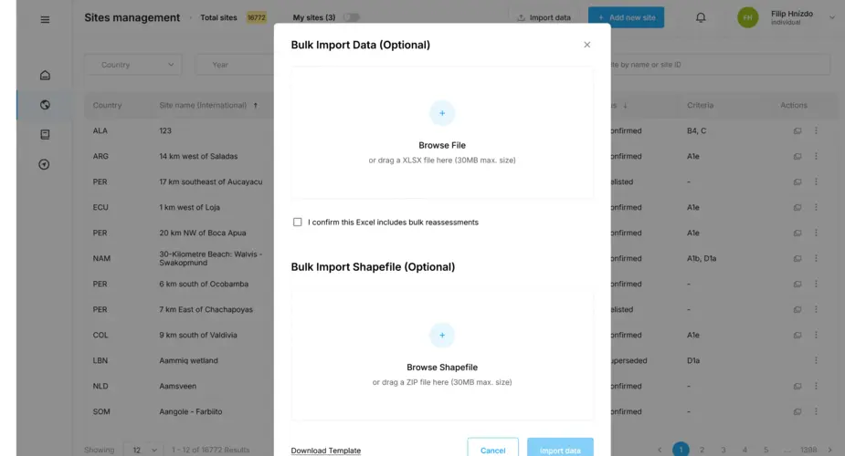
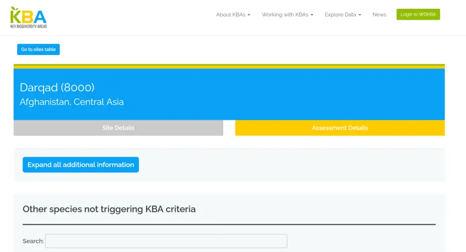
Key Biodiversity Areas database importers and geospatial database
We have worked with Birdlife International on their World Database of Keybiodiversity Areas since 2023 and in 2024 were asked to build a new system to allow organisations to bulk upload sites to be proposed as Key Biodiversity Areas.
Categories

Newham heritage centre consultancy
A consultultancy project around the best ways to digitise the Newham historical archive and showcase their upcoming heritage centre.
Categories
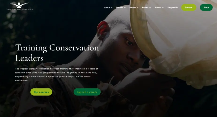
Tropical Biology Association website support
Since 2023 we have worked with the Tropical Biology Association to support and improve their WordPress website.
Categories
Technologies
Key Biodiversity Areas factsheets scraper, archive and backup system
We worked with the Key Biodiversity Areas team at Birdlife International to build a scraper of their World Database of Key Biodiversity Areas
Categories
Technologies
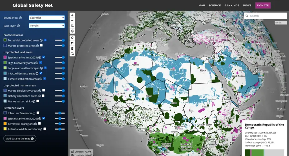
Global Safety Net map
We built a globe-view interactive map for One Earth's Global Safety Net project featuring more than a dozen categorised raster and vector layers and data queries mapped to a user selectable view of countries, ecoregions, bioregions and states.
Categories
Technologies
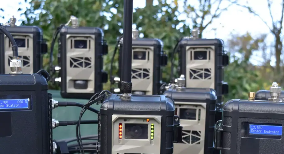
Instant Detect satellite wildlife monitoring system
Instant Detect 2.0 is a wildlife, environment and threat monitoring system designed by conservationists for conservationists. The system consists of multiple battery-powered cameras and sensors that capture images and data and then transmit it to the cloud in near real-time using satellite connectivity.
Categories
Seabird Tracking Database
We built a new version of the collaborative Seabird Tracking Database for Birdlife International.
Categories
Technologies
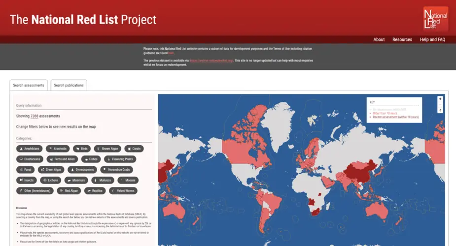
The National Red List Project
Creating a new database, interactive map and importer of thousands of historic records for the National Red List.
Categories
Technologies

Ticketing pipelines and big data APIs for hundreds of arts venues in the UK
Octophin built ticketing pipelines for many ticketing systems (Spektrix, TicketSolve, Tessitura and more); creating APIs, scrapers and importers to ingest, parse, normalise, analyse and anonymise (via Experian APIs) daily data on tickets, people and events.
Categories
Technologies
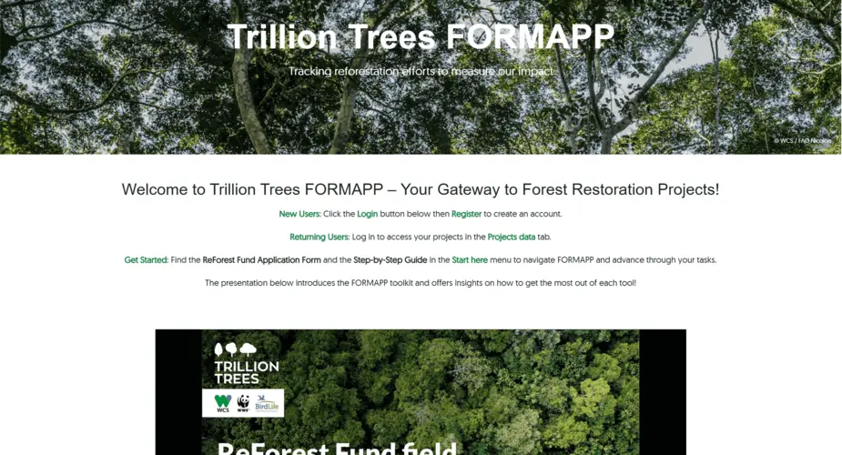
Trillion Trees Consultancy
Reforestation data collection research project for Trillion Trees (FORMAPP)
Categories
Fauna & Flora International - donations system support
We worked with Fauna & Flora International on creating better integration between their CRM system and donations payment gateway.
Categories
Technologies

Technical Consultancy and development for 51Degrees
Octophin Digital have provided consultancy, training and Node.js and PHP development work for 51Degrees, providers of a popular device detection system.