
Our work
Octophin build interactive maps, apps, websites, community platforms and databases solely for the environment conservation, arts and heritage sectors.
We have world-leading knowledge on interactive mapping of all aspects of the natural world and its sustainable communities (from seafood to forestry), and have spoken on building maps for good at
several international conferences. We have built many collaborative databases of wildlife sightings, green spaces, sustainable seafood, recipes and more, and manage a community platform and wiki for conservation technologists and a citizen science wildife identification gaming platform both with thousands of active members.
On the arts side of our work we have worked on big data projects (demographic mapping, dashboard building) for Arts Council England via The Audience Agency and Artsadmin for many years, built the website for real world adventure games company HiddenCity (recently made an official partner of the 007 James Bond brand), built interactive maps and artist databases for the Crouch End Open Studios events and worked with Newham Council on digitisation projects for their new heritage centre.
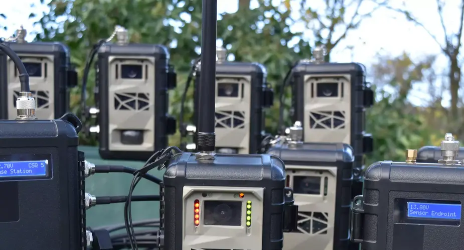
Instant Detect satellite wildlife monitoring system
Instant Detect 2.0 is a wildlife, environment and threat monitoring system designed by conservationists for conservationists. The system consists of multiple battery-powered cameras and sensors that capture images and data and then transmit it to the cloud in near real-time using satellite connectivity.
Categories
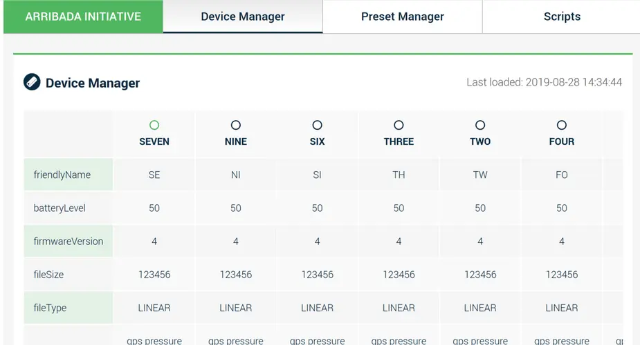
SCUTE - Conservation hardware administration system
SCUTE will build an extendable graphical administration interface for hardware devices from JSON schema files, allowing people to view reports about connected devices, update and manage configuration